Wildfire Flood Risk
Skip to content
When autocomplete results are available use up and down arrows to review and enter to select. Touch device users, explore by touch or with swipe gestures.
Log in
Sign up
Explore
Wildfire flood risk
Discover Pinterest’s best ideas and inspiration for Wildfire flood risk. Get inspired and try out new things.
Last updated 20h
Related interests
River Flash Flood
Aftermath Of Flood Disaster
Urban Planning Flood Risk
Wildfire Management Techniques
Flood Risk Assessment Example
See more
Wildfire flood risk and more
Explore related boards
World Forest Day
Chaoyew
,
14 Pins
·
,
2y
Flood Preparedness and Response in Rural towns
Rajnish Chaudhari
,
34 Pins
·
,
1y
Flood Safety issue in Brisbane among older adults
Navdeep Kaur
,
20 Pins
·
,
2y
Urban sketching
bhagyashree
,
202 Pins
·
,
2mo
Website
nathanial clay
,
86 Pins
·
,
10mo
See more
Flood Risk Map 2023
Flood Risk Management Project Diagram
Annual Flooding Risk Map
Flood Risk Analysis Chart
Flood Risk Map By State
City Flood Risk Analysis
Floodplain Risk Map
Flood Risk Visualization Diagram
Urban Flood Risk Map
Flood Risk Map 2023
How To Analyze Flood Maps
Infrastructure Planning For Floods
Urban Flooding Analysis
Urban Flooding Impact Analysis
Annual Flooding Risk Map
Flood Diagram
Flood Risk Management Research
River Flood Diagram
City Flood Risk Analysis
Flood risks on the rise - Greater loss prevention is needed | Munich Re
Wild Fire
Canning
Instagram
Wild Fire
Garden Watering System
Wood Heater
Land Management
Fire Protection
Radiant Heat
Emergency Service
Permaculture
Water Supply
How To Level Ground
Preparing for Wildfire
Wildfire Prevention Checklist
How To Recover After A Wildfire
Wildfire Emergency Response Tips
Wildfire Safety Planning
Wildfire Prevention Resources
Wildfire Response And Prevention Tips
How To Respond To Wildfires
Wildfire Prevention Education
Wildfire Preparedness Guide Infographic
Wildfire Prevention Checklist
How To Read Flood Risk Maps
How To Find Flood Zones
Understanding Flood Patterns
How To Analyze Flood Maps
Pre Flood Map
How To Read Flood Maps
Great Flood Map
Flood Plain Map For Construction
Map Of The Great Flood
Overview - Flood Maps
Flood Safety Advice
Urban Flooding Safety Tips
Safety After Flooding
Flood Recovery Tips
Safety Tips During Floods
Flood Safety Guide
Flood Prevention Safety Guide
Prepare For Indian Floods
Educational Flood Safety Tips
Flood Safety Advice
Wildfire Safety Awareness
Wildfire Prevention Awareness
How To Identify Wildfires
Wildfire Safety Measures
Wildfire Impact On Ecosystems
Wildfire Prevention
Wildfire Safety Tips Infographic
Wildfire Aftermath Ecology
Air Quality Infographic
Wildfire Smoke Exposure
Flood Diagram
Flood Diagram Easy
Flood Diagram For Kids
How Does A Flood Happen
What Causes A Flood
Floods Geography
Understanding Flood Models
Floods In Geography
Flood Diagram
Emergency Flood Safety Advice
Safety After Flooding
Exploring Flooded Areas Safely
Natural Disaster Flood Response
Emergency Response To Industrial Flooding
Emergency Flood Restoration Service
Preparing For Flood-prone Areas
City Flood Emergency Situation
Emergency Flood Restoration Adelaide
Emergency Flood Service - Australia
When Do Floods Usually Occur
What Causes Flooding
What Causes A Flood
What Are The Effects Of Floods
Causes Of A Flood
Flood Safety Tips Text
Natural Disaster Flood Response
Flood Fact Infographic
Facts About Floods
When Do Floods Usually Occur
How To Track Wildfires
Historical Map Idaho Wildfires
Wildfire Map Alaska
Understanding Wildfire Patterns
Wildfire Impact On Ecosystems
Monitoring Wildfire Activity
Oregon Wildfires Map
Monitoring Wildfire Spread
How To Stay Informed About Wildfires
Wildfire Maps & Response Support | Wildfire Disaster Program
Fire In Forest
Forest Fire Ecological Effects
Fire Plant
Forest Fire With Flames
Burning Trees Fire
Wildfire In Forest At Sunset
Environmental Impacts Of Wildfires
Fire Nature Aesthetic
Fire Burning In Amazon Rainforest
Wildfire
Wildfire Safety Planning
Fire Recovery Planning
Wildfire Safety Measures
Wildfire Response And Evacuation Tips
Forest Fire Hazard Classification
Understanding Fire Danger Levels
Wildfire Safety Planning Guide
Substation Fire Risk Management Guide
Bushfire Evacuation Planning
AJEM January 2024 - Bushfire risk, messaging and older people: setting a research agenda | Australian Disaster Resilience Knowledge Hub
Wildfire Evacuation Checklist
Forest Fire Prevention Tips
Wildfire Safety Planning
Wildfire Prevention Resources
Wildfire Safety Guide For Communities
Wildfire Safety Poster
Wildfire Prevention Strategies
Forest Fire Prevention Guide
Rural Wildfire Safety Tips
Inside First Aid
Emergency Flood Safety Advice
Exploring Flooded Areas Safely
How To Navigate Flooded Areas
How To Receive Flood Warnings
How To Navigate Floods
Environment Agency Flood Protection
How To Navigate Floods Safely
Understanding Uk Flood Risks
Flood Hazard Area Warning
🌊 Prepare & Protect: Environment Agency Flood Warnings 🚨
How To Analyze Flood Maps
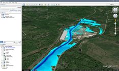
Hydroelectric Dam Simulation
Reporting Flood Impacts Effectively
River Flood Prediction Tools
Flood Susceptibility Analysis Tutorial
Monitoring Flood Risk Areas
Geospatial Technology Flood Prevention
Historical Flood Analysis Tool Map
Hydroelectric Dam Infographic
Page Not Found – CivilGEO | Stormwater & Hydraulic Modeling Software
Emergency Preparedness For Floods
Flood Safety Tips
How To Recover After A Flood
Post-flood Recovery Guide
Tips For After A Flood Infographic
After A Flood Safety Tips
Urban Flooding Safety Tips
Severe Flooding Safety Advice
5 Tips for After Flood
Map Of Johnstown Flood Area
Weather Risk Map Australia
Map Of Australia Fires
Johnstown Flood Map
Australia Wildfires Map
Map Of Flood-prone Areas
Brisbane Flood Risk Map
Australia Bushfire Map 2009
India Flood-prone Regions Map
Map Of Johnstown Flood Area
Aerial View Of Coastal Damage
Aerial View Of Coastal Flooding
Aerial View Of Flooded Village
Norfolk Coast From Above
Norfolk Coastline Erosion Report
Flooded Coastal Town
Happisburgh Coastal Erosion
Cromer Beach Aerial Photo
Flooded Norfolk
Aerial View Of Coastal Damage