
Blenheimweather
- Updated
- Sunrise:
- Sunset:
14°C

- 20°C8°C
Showers, clearing and becoming partly cloudy in the evening. Northwesterlies, strong at times.
- 18°C8°C
The odd shower, clearing to fine for a time in the afternoon. Showers developing in the evening. Northerlies, turning southerly late evening.
- 14°C7°C
Occasional rain. Southerlies.
For more detailed weather information visit MetService.
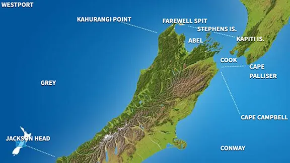
Marine Coastal Forecasts - Cook
Forecast:
Saturday: Northerly 35 knots, easing to 25 knots in the afternoon. Very rough sea easing. Southerly swell 1 metre easing. Poor visibility in rain, with possibly squally thunderstorms north of Cape Terawhiti.
Outlook:
Outlook following 3 days:
Sunday: Northerly 20 knots, turning southerly 20 knots in the evening. Sea moderate. Poor visibility in showers, easing in the afternoon.
Monday: Southerly 25 knots, rising to 40 knots in the afternoon. Sea becoming very rough. Southerly swell becoming heavy.
Tuesday: Southerly 45 knots. Sea high. Heavy southerly swell.
Wednesday: Southerly 45 knots, easing to 35 knots later. High sea easing. Heavy southerly swell easing.
Marine Coastal Forecasts - Castlepoint
Forecast:
Saturday: Northerly 25 knots but 35 knots south of Cape Palliser. Becoming northerly 30 knots everywhere in the afternoon, easing to 20 knots in the south in the evening. Very rough sea in the south easing. Southwest swell 1 metre. Northerly swell 1 metre developing. Poor visibility in rain developing, mainly in the south.
Outlook:
Outlook following 3 days:
Sunday: Northerly 25 knots, easing to northwest 15 knots in the morning. Becoming variable 10 knots in the evening. Rough sea easing. Southwest swell 1 metre. Northerly swell rising to 2 metres. Fair visibility in showers.
Monday: Southeast 15 knots, rising to 25 knots in the morning. Becoming southeast 20 knots but 35 knots south of Cape Palliser in the afternoon. Sea becoming very rough in the south. Easterly swell becoming moderate.
Tuesday: Southeast 20 knots but 35 knots south of Cape Palliser. Becoming southerly 35 knots everywhere late. Sea very rough. Easterly swell becoming heavy.
Wednesday: Southerly 40 knots, easing to 30 knots later. Very rough sea easing. Heavy southerly swell.
Marine Coastal Forecasts - Conway
Forecast:
Saturday: Northerly 20 knots but 35 knots north of Kaikoura Peninsula. Easing to northerly 15 knots but 25 knots in the north in the afternoon. Becoming northerly 15 knots everywhere late evening. Very rough sea in the north, easing. Northeast swell rising to 2 metres offshore for a time. Southerly swell 1 metre.
Outlook:
Outlook following 3 days:
Sunday: Northerly 15 knots, turning southwest 15 knots in the morning. Sea slight. Southwest swell 1 metre. Northeast swell 1 metre. Poor visibility in periods of rain developing in the afternoon.
Monday: Southerly 20 knots, rising to southeast 35 knots in the morning. Easing to southerly 25 knots in the evening. Sea becoming very rough for a time. Southeast swell becoming moderate.
Tuesday: Southerly 25 knots, becoming southerly 30 knots but 40 knots north of Kaikoura Peninsula early. Sea becoming very rough in the north. Southeast swell becoming heavy.
Wednesday: Becoming southerly 30 knots everywhere early. Very rough sea in the north easing. Heavy southeast swell easing.